Angus, Director of Landscape Architecture, outlines how the recent project City Walk in Abuja, Nigeria addresses the issues caused by rapid urbanisation with the utilisation of nature as infrastructure and other integrated design responses.
Return to Future ThinkingNature as Infrastructure: Supporting water management and public life in Nigeria

Contact Angus Palmer, Director, Benoy Landscape Architecture
angus.palmer@benoy.com
Nature as the backbone to urbanisation
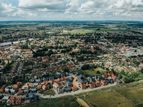
Rapid urbanisation in the Nigerian capital is placing pressure on land, infrastructure, and environmental systems. Extreme seasonal rainfall and drought also expose Abuja to flooding and land degradation. With a population projected to more than double by 2050, demand is outpacing the delivery of drainage solutions and publicly accessible open space.
According to the World Health Organisation (WHO), poor urban water management increases malaria exposure. In a country that accounts for the highest share of malaria cases globally (WHO 2025 World Malaria Report), there is an urgent need for integrated environmental and design responses.
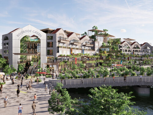
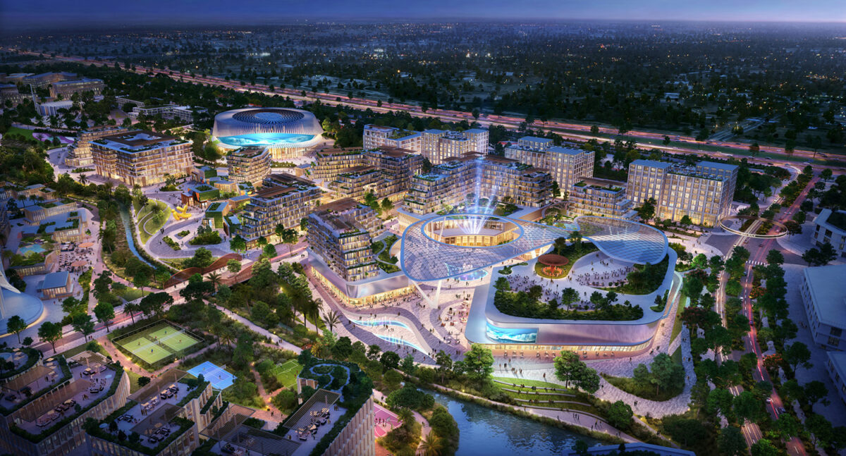
Our concept for City Walk Abuja proposes a mixed-use masterplan on the outskirts of the city, prioritising water management and community space. Integrating residential, commercial, cultural, and civic spaces, our vision is for a walkable urban environment structured around landscape and public life.
The existing site
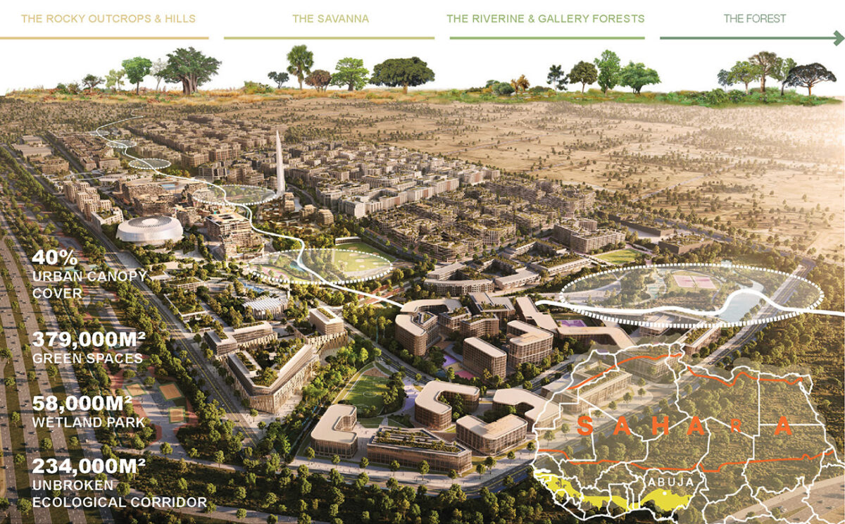
Abuja sits within the Guinean Forest – Savanna ecoregion, in the centre of Nigeria, where savanna and tropical systems meet. Located along the airport corridor, the 2.5km² site for City Walk forms a gateway between the city centre and expanding suburbs. Situated within a fragile environmental context, landscape solutions are essential for supporting biodiversity and slowing desertification in the area.
In this context, where infrastructure systems are still evolving and urbanisation is often uncoordinated, our masterplan explores how landscape can operate as a localised layer of infrastructure, working alongside engineered systems to deliver on-site water management, ecological rehabilitation, and accessible public space.
Five design principles for a resilient masterplan
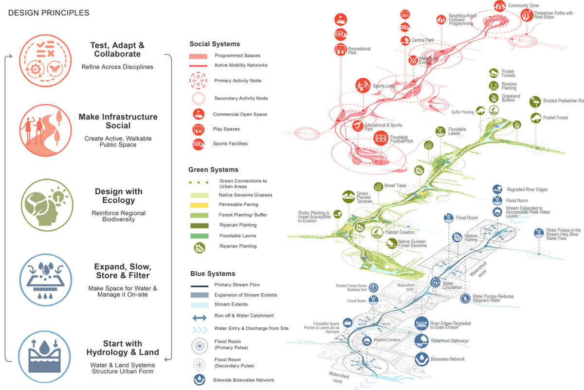
Our approach has been guided by a set of design principles specific to the context, helping us structure our process and shape the final concept masterplan.
1. Start with hydrology and land: water systems structure urban form
We started our design process by familiarising ourselves with the site and its existing landscape, seasonal water flows and patterns of use. Rather than impose a new landscape, we designed around the existing features, including a stream that flows through a ravine from north to south. This functions as the central seam from which our urban and green fabric expand.
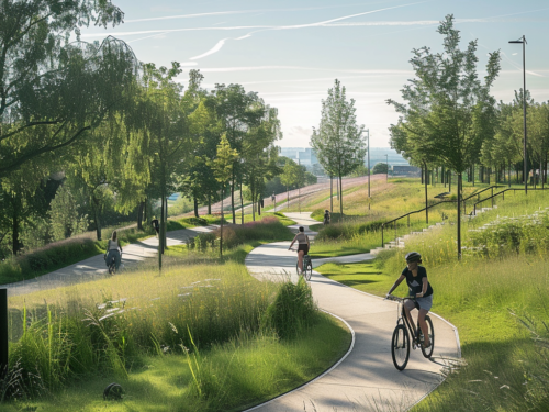
Running through the length of the site, we designed a continuous green spine around the stream to provide a natural flood barrier, structure movement, punctuate public spaces and guide the placement of built developments. The backbone to the masterplan, this green spine anchors the mixed-use proposal while being the connector between different zones.
2. Expand, slow, store & filter: manage water on-site
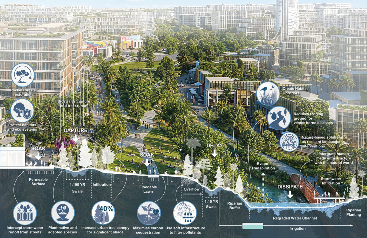
We worked with drainage engineers to develop a network of swales, wetlands and permeable surfaces that slow, store, filter and dissipate stormwater, including for 1‑in-100-year events. Creating a ‘sponge city’ effect, these systems manage water directly on-site, improving water quality while reducing reliance on surrounding, often incomplete, drainage infrastructure.
Alongside these measures, we also embedded floodable landscapes, such as football pitches and lawns, to reduce stagnant conditions linked to public health risks while creating flexible recreational space during dry periods. The combination of water management techniques reduces surface runoff, especially during peak flood periods, and allows water to infiltrate the ground or be temporarily stored within these designated floodable landscapes.
By treating landscape as the first line of defence, we’ve implemented ecological infrastructure that doubles as public space. And by mimicking natural water cycles through the landscape, we’ve reframed water as a resource in the urban context, rather than a risk. Mitigating flood risk also helps preserve and enhance biodiversity while contributing to a more resilient urban ecosystem.
3. Design with ecology: reinforce regional biodiversity
Our planting strategy translates the Guinean Forest – Savanna environment into riverine corridors, savanna grasslands, and forest clusters. We conducted a study of local ground cover, shrubs and trees for these different landscape typologies to create a drought-resistant palette specifically suited to the different layers of the site. Integrated with the sitewide sustainable drainage systems (SuDS) network, these landscapes stabilise soils, support biodiversity, and contribute to initiatives, such as the African Union’s Great Green Wall project, at a local scale.
The masterplan features a 40% urban canopy cover, creating shade and mitigating the heat island effect. Beyond the benefit to people, the tree cover also provides corridors for birdlife, and pocket forests help restore ecosystems and protect habitats.
4. Make infrastructure social: create active, walkable public space
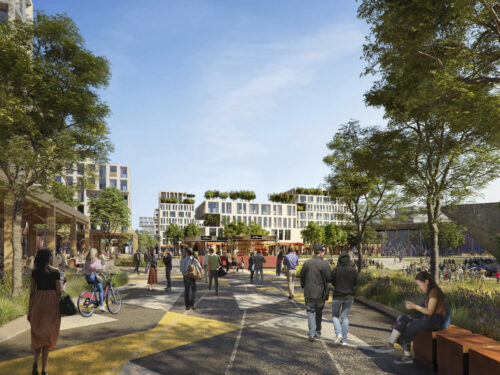
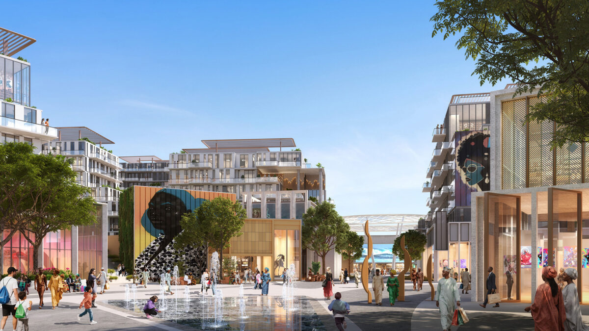
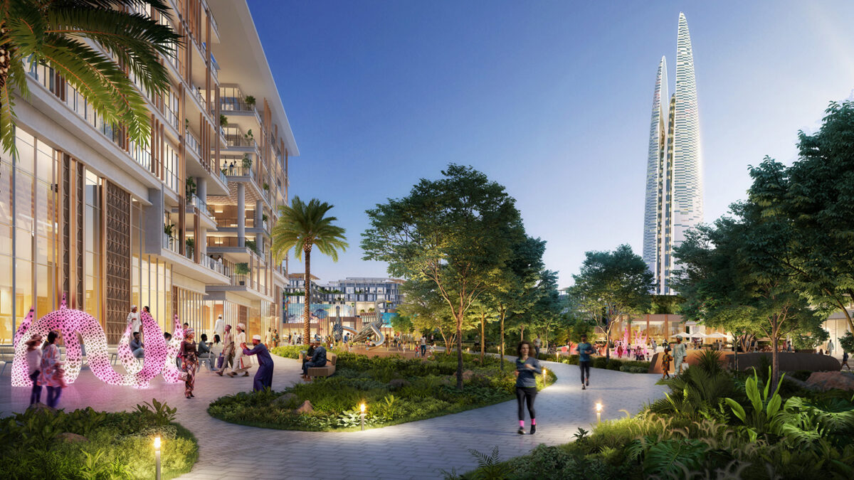
While it was important to create a masterplan that responds to the local climate and ecology, it was crucial for it to also be a place that supports human life and community vitality. By adopting a landscape-led approach, we’ve actively made space for people to connect with the natural world.
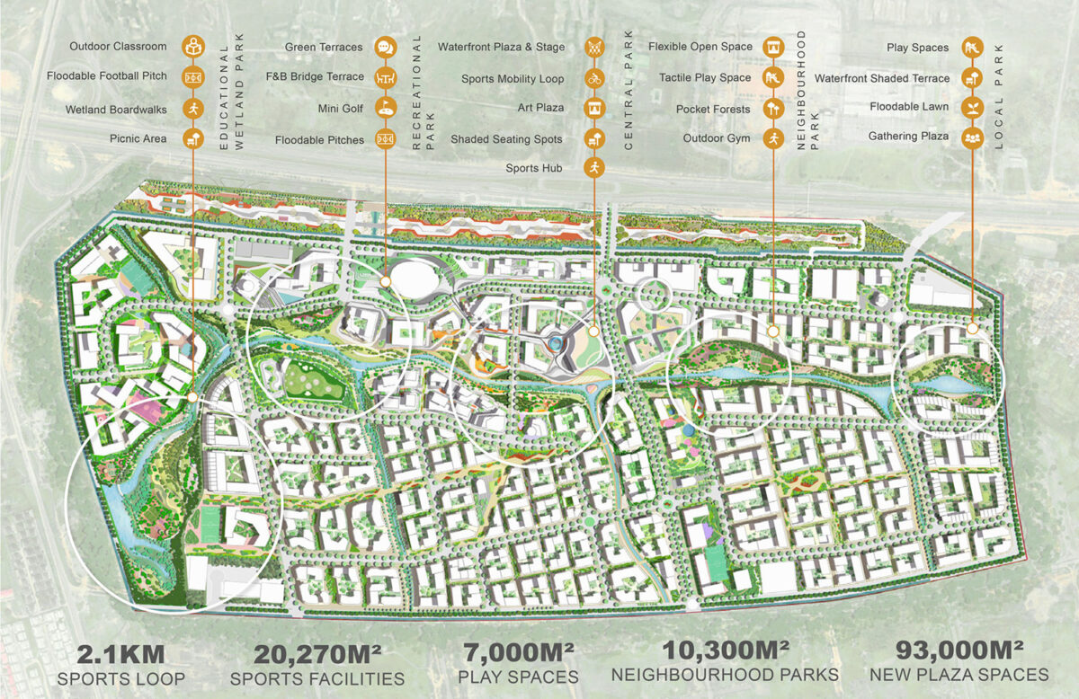
Connected by a 2.1km sports loop, the masterplan incorporates 93,000m² of plazas, 20,270m² of sports facilities, 7,000m² of play spaces and 10,300m² of neighbourhood parks alongside pocket forests and waterways.
These spaces are organised around five purpose-driven parks: an educational wetland park, recreational park, central park, neighbourhood park and local park. Each park is tailored for different demographics and their needs, from school children and families in the education and neighbourhood parks to visitors and the wider community in the recreational and central parks.
Spanning the north – south axis of the site, each park anchors an activity zone and contributes to a linear journey through the masterplan. We’ve designed City Walk to provide inclusive, equitable access to green space through a network of paths, event spaces, and neighbourhood amenities. A key element of the community offer is the Art District, comprising 12,000m² of cultural spaces that connect to retail, leisure, and office uses via a central boulevard and events space.
5. Test, adapt and collaborate: refine across disciplines
We continuously evolved the design following iterative feedback between landscape design and hydrological modelling. Flood patterns informed our spatial structure, while programming and mobility loops transformed the ravine into walkable public spaces.
By orienting active uses towards these areas, the floodable parks support everyday social life while accommodating peak water events, without disrupting to the residential and commercial elements spanning both sides of the ravine.
Landscape as a functional driver for change
City Walk Abuja demonstrates the potential for landscape to function as defensive, resilient infrastructure in rapidly urbanising contexts where conventional systems are still evolving. Rather than treating landscape as residual space, we’ve utilised hydrology, ecology and public life to structure the masterplan. The result is a decentralised and scalable framework that manages water on-site, restores ecological systems, and creates a healthier, more liveable model of urbanisation for Abuja.
Related articles